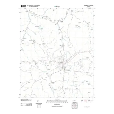
2010 Map of Hohenwald
USGS Topo · Published 2010About this map
Hohenwald serves as the central hub of this Middle Tennessee landscape, where the plateau terrain is deeply incised by a dense network of hollows and creek branches. The settlement pattern is defined by family-named landmarks and a legacy of mineral exploration, evidenced by numerous sites like the Smith Bank Number One Prospect and Hughes Bank Prospect. The area's social history is visible through scattered community markers, including the Swiss Cemetery and Saint Peters Cemetery near the town center, while smaller hamlets like Kimmins are identified by their own Post Office.
Find a feature on this map
135 named features on this map. Tap any name to fly to it.
Don’t see what you’re looking for? This feature index may not catch every label — zoom into the map to look around manually.
Map Details
Editions of this 2010 Hohenwald Map
This is the sole edition of this map. No revisions or reprints were ever made.
Other maps of this area

1901 · Colombia
USGS Topo · 1:125,000

1905 · Waynesboro
USGS Topo · 1:125,000

1936 · Riverside
USGS Topo · 1:24,000

1936 · Graves Spring
USGS Topo · 1:24,000

1936 · Pleasantville
USGS Topo · 1:24,000

1936 · Beaverdam Springs
USGS Topo · 1:24,000

1936 · Henryville
USGS Topo · 1:24,000

1936 · Sunrise
USGS Topo · 1:24,000

1936 · Kimmins
USGS Topo · 1:24,000

1936 · Topsy
USGS Topo · 1:24,000