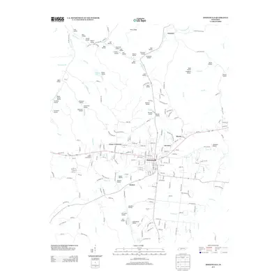
2013 Map of Hohenwald
USGS Topo · Published 2013About this map
Hohenwald serves as the central hub of this Lewis County landscape, where the local street grid intersects with several primary routes. The surrounding geography is defined by a dense network of hollows named for local families and landmarks, such as Dean Hollow, Ammons Hollow, and Mill Hollow. These narrow valleys feed into larger waterways like Indian Cr and Grinders Cr, illustrating a classic dissected plateau pattern. Smaller outlying communities like Lomax Crossroads, Theodore, and Blondy are scattered along the ridgelines, connected by winding roads that follow the natural topography. Transport and utility are evidenced by the John A Baker Field Airport west of the main town and the inclusion of various springs, including Crystal Spring and Downey Spring, which likely served as vital water sources for early settlers and agriculture.
Find a feature on this map
215 named features on this map. Tap any name to fly to it.
Don’t see what you’re looking for? This feature index may not catch every label — zoom into the map to look around manually.
Map Details
Editions of this 2013 Hohenwald Map
This is the sole edition of this map. No revisions or reprints were ever made.
Other maps of this area

1901 · Colombia
USGS Topo · 1:125,000

1905 · Waynesboro
USGS Topo · 1:125,000

1936 · Riverside
USGS Topo · 1:24,000

1936 · Graves Spring
USGS Topo · 1:24,000

1936 · Pleasantville
USGS Topo · 1:24,000

1936 · Beaverdam Springs
USGS Topo · 1:24,000

1936 · Henryville
USGS Topo · 1:24,000

1936 · Sunrise
USGS Topo · 1:24,000

1936 · Kimmins
USGS Topo · 1:24,000

1936 · Topsy
USGS Topo · 1:24,000