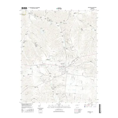
2016 Map of Hohenwald
USGS Topo · Published 2016About this map
Hohenwald serves as the focal point of this Lewis County survey, exhibiting a detailed street grid and residential expansion into neighboring Blondy and Theodore. The landscape is defined by an intricate network of hollows, such as Sugartree Hollow and Ammons Hollow, which historically dictated the movement of people and the placement of small family cemeteries. Numerous burial sites including Bastin Cem, Conder Cem, and Skelton Cem are scattered throughout the hills, providing a valuable record for genealogical research in this part of Tennessee. To the south, the name Rockhouse Railroad Rd preserves the memory of former rail corridors that once linked these timber and mining communities. Notable water features like Highland Lake and Crystal Spring reflect the region's natural drainage into the Cane Creek and Rockhouse Creek systems.
Find a feature on this map
187 named features on this map. Tap any name to fly to it.
Don’t see what you’re looking for? This feature index may not catch every label — zoom into the map to look around manually.
Map Details
Editions of this 2016 Hohenwald Map
This is the sole edition of this map. No revisions or reprints were ever made.
Other maps of this area

1901 · Colombia
USGS Topo · 1:125,000

1905 · Waynesboro
USGS Topo · 1:125,000

1936 · Riverside
USGS Topo · 1:24,000

1936 · Graves Spring
USGS Topo · 1:24,000

1936 · Pleasantville
USGS Topo · 1:24,000

1936 · Beaverdam Springs
USGS Topo · 1:24,000

1936 · Henryville
USGS Topo · 1:24,000

1936 · Sunrise
USGS Topo · 1:24,000

1936 · Kimmins
USGS Topo · 1:24,000

1936 · Topsy
USGS Topo · 1:24,000