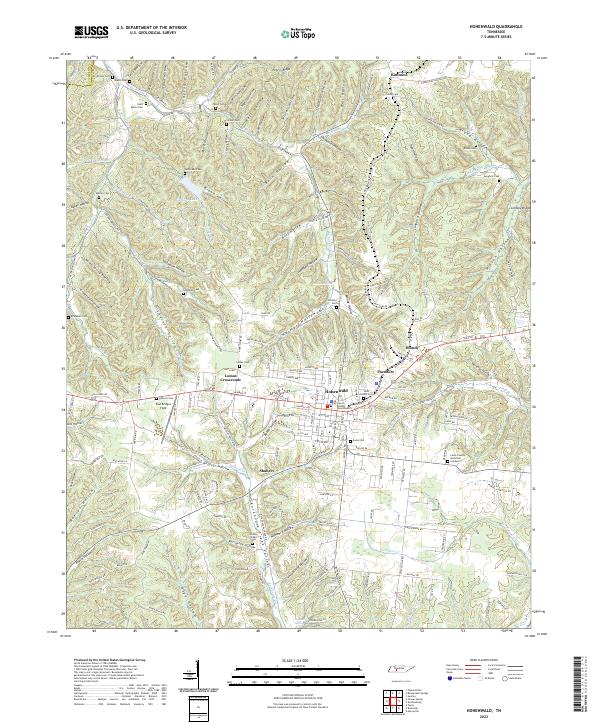
2022 Map of Hohenwald
USGS Topo · Published 2022About this map
Hohenwald serves as the central hub of this Lewis County landscape, where the Lewis County Courthouse anchors a town plan defined by a grid of numbered streets and avenues. The surrounding terrain is deeply carved by a dense network of hollows, including Stillhouse Hollow, Barn Hollow, and Sugartree Hollow, which demonstrate the traditional Appalachian settlement patterns where homesteads and cemeteries follow the winding valley floors. This 2022 survey captures the modern extent of the town alongside outlying communities like Blondy and Lomax Crossroads. For genealogists, the map is particularly useful for locating numerous small burial grounds such as Talley Cem, Goodman Cem, and Lees Lake Cem, many of which are tucked away near the headwaters of local streams like Indian Cr and Cane Cr. These scattered landmarks reflect the long-standing family ties to specific ridges and valleys across the Hickman and Lewis county line.
Find a feature on this map
149 named features on this map. Tap any name to fly to it.
Don’t see what you’re looking for? This feature index may not catch every label — zoom into the map to look around manually.
Map Details
Editions of this 2022 Hohenwald Map
This is the sole edition of this map. No revisions or reprints were ever made.
Other maps of this area

1901 · Colombia
USGS Topo · 1:125,000

1905 · Waynesboro
USGS Topo · 1:125,000

1936 · Riverside
USGS Topo · 1:24,000

1936 · Graves Spring
USGS Topo · 1:24,000

1936 · Pleasantville
USGS Topo · 1:24,000

1936 · Beaverdam Springs
USGS Topo · 1:24,000

1936 · Henryville
USGS Topo · 1:24,000

1936 · Sunrise
USGS Topo · 1:24,000

1936 · Kimmins
USGS Topo · 1:24,000

1936 · Topsy
USGS Topo · 1:24,000