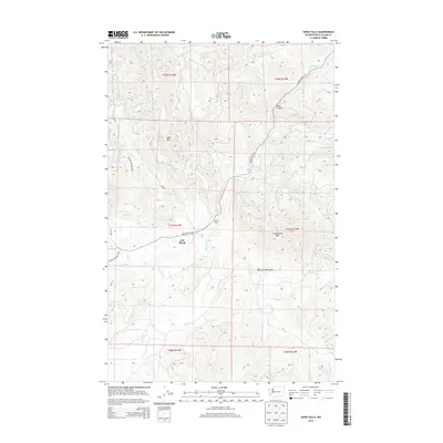
2014 Map of Hoko Falls
USGS Topo · Published 2014About this map
The Hoko River drainage system dominates this coastal Washington landscape, where the settlement of Old Royal and Hoko Camp reflect the area's timber and remote residency patterns. High terrain rises sharply from the river valleys, notably at Sekiu Mtn and Stolzenburg Mtn, which frame the deep contours of Blue Canyon. To the west, the boundary of Olympic National Park marks a shift toward protected wilderness, while a dense network of tributaries including Browns Cr, Haehule Cr, and the S Fork Sekiu River carve the surrounding ridges. The primary corridor through this Clallam County territory is Hoko Ozette Rd, providing the essential link between these isolated forest settlements and the broader Olympic Peninsula.
Find a feature on this map
27 named features on this map. Tap any name to fly to it.
Don’t see what you’re looking for? This feature index may not catch every label — zoom into the map to look around manually.
Map Details
Editions of this 2014 Hoko Falls Map
This is the sole edition of this map. No revisions or reprints were ever made.
Other maps of this area

1935 · Clallam
USGS Topo · 1:62,500

1935 · Ozette Lake
USGS Topo · 1:62,500

1935 · Lake Pleasant
USGS Topo · 1:62,500

1938 · Cape Flattery
USGS Topo · 1:62,500

1942 · Clallam
USGS Topo · 1:62,500

1942 · Ozette Lake
USGS Topo · 1:62,500

1942 · Lake Pleasant
USGS Topo · 1:62,500

1953 · Cape Flattery
USGS Topo · 1:250,000

1956 · Ozette Lake
USGS Topo · 1:62,500

1957 · Lake Pleasant
USGS Topo · 1:62,500