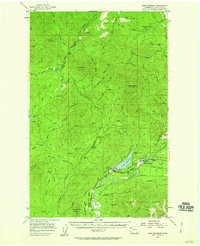
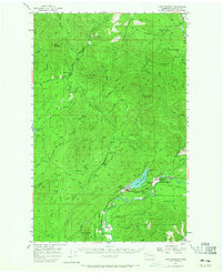
1957 Map of Lake Pleasant
USGS Topo · Published 1958About this map
The logging economy of the Olympic Peninsula is etched across this landscape in the mid-1950s, defined by a dense network of timber roads and specialized settlements. At the heart of the region, Tyee (Beaver PO) and Sappho serve as local hubs, while smaller outposts like Hoko Camp, Dickey Camp, and Old Royal mark the reach of forest operations. The area is heavily intersected by the remnants of industrial infrastructure, shown as numerous segments of Railroad Grade and Old Railroad Grade that once hauled timber to coastal mills. Beyond the work sites, local life is anchored by the Beaver School and the Clallam Honor Camp located near Charley Creek. The terrain is dominated by the high points of Ellis Mountain and Stolzenberg Mountain, with the pristine waters of Dickey Lake and the Soleduck River providing a sharp contrast to the surrounding working forest.
Find a feature on this map
69 named features on this map. Tap any name to fly to it.
Don’t see what you’re looking for? This feature index may not catch every label — zoom into the map to look around manually.
Map Details
Editions of this 1957 Lake Pleasant Map

Other maps of this area
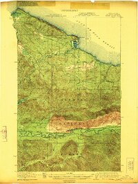
1922 · Pysht
USGS Topo · 1:62,500

1935 · Clallam
USGS Topo · 1:62,500

1935 · Ozette Lake
USGS Topo · 1:62,500

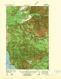
1935 · Lake Pleasant
USGS Topo · 1:62,500

1938 · Cape Flattery
USGS Topo · 1:62,500
1939 · Forks
USGS Topo · 1:62,500

1942 · Pysht
USGS Topo · 1:62,500

1942 · Clallam
USGS Topo · 1:62,500

1942 · Ozette Lake
USGS Topo · 1:62,500

1942 · Lake Pleasant
USGS Topo · 1:62,500