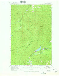
1957 Map of Lake Pleasant
USGS Topo · Published 1965About this map
Timber harvesting and regional transport shape the landscape on the northern Olympic Peninsula, where logging camps and specialized outposts dot the river valleys. The Hoko River and its numerous branches, such as the North Branch Hoko River, dominate the central terrain alongside named peaks like Stolzenberg Mountain. The map captures a specific moment in the mid-1950s when the Logging Railroad network and numerous segments of Old Railroad Grade reveal the industrial history of the Clallam County woods.
Find a feature on this map
68 named features on this map. Tap any name to fly to it.
Don’t see what you’re looking for? This feature index may not catch every label — zoom into the map to look around manually.
Map Details
Editions of this 1957 Lake Pleasant Map

Other maps of this area

1922 · Pysht
USGS Topo · 1:62,500

1935 · Clallam
USGS Topo · 1:62,500

1935 · Ozette Lake
USGS Topo · 1:62,500

1935 · Lake Pleasant
USGS Topo · 1:62,500

1938 · Cape Flattery
USGS Topo · 1:62,500

1939 · Forks
USGS Topo · 1:62,500

1942 · Pysht
USGS Topo · 1:62,500

1942 · Clallam
USGS Topo · 1:62,500

1942 · Ozette Lake
USGS Topo · 1:62,500

1942 · Lake Pleasant
USGS Topo · 1:62,500