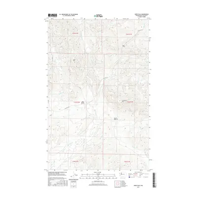
2017 Map of Hoko Falls
USGS Topo · Published 2017About this map
Old Royal sits along the western edge of this territory, where the terrain transitions toward the rugged interior of the Olympic Mountains. This northern Olympic Peninsula landscape is defined by its complex drainage network, primarily shaped by the winding Hoko River and the Sekiu River. Elevation changes are significant across this quadrant, rising from the river valleys to prominent peaks such as Sekiu Mtn and Stolzenburg Mtn. These ridges separate various watersheds, including the S Fork Sekiu River and numerous tributaries like Herman Cr and Big River. Notable water features such as Hoko Falls and Herman Falls demonstrate the steep gradients of the local streams. Transport through these coastal highlands is anchored by the Hoko Ozette Rd, providing a vital corridor through the forested slopes and past geological landmarks like Blue Canyon.
Find a feature on this map
25 named features on this map. Tap any name to fly to it.
Don’t see what you’re looking for? This feature index may not catch every label — zoom into the map to look around manually.
Map Details
Editions of this 2017 Hoko Falls Map
This is the sole edition of this map. No revisions or reprints were ever made.
Other maps of this area

1935 · Clallam
USGS Topo · 1:62,500

1935 · Ozette Lake
USGS Topo · 1:62,500

1935 · Lake Pleasant
USGS Topo · 1:62,500

1938 · Cape Flattery
USGS Topo · 1:62,500

1942 · Clallam
USGS Topo · 1:62,500

1942 · Ozette Lake
USGS Topo · 1:62,500

1942 · Lake Pleasant
USGS Topo · 1:62,500

1953 · Cape Flattery
USGS Topo · 1:250,000

1956 · Ozette Lake
USGS Topo · 1:62,500

1957 · Lake Pleasant
USGS Topo · 1:62,500