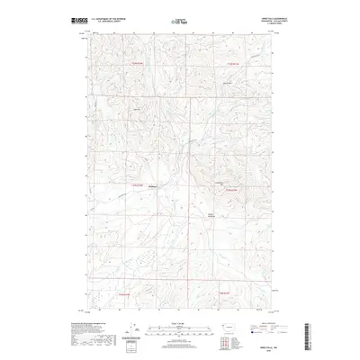
2020 Map of Hoko Falls
USGS Topo · Published 2020About this map
Old Royal sits along the winding corridor of the Hoko River in this detailed survey of Clallam County. The landscape is defined by the steep rises of the Olympic Mountains, with Sekiu Mtn and Stolzenburg Mtn providing significant vertical relief across the quadrangle. This area serves as a critical watershed where the S Fork Sekiu River, Big River, and Herman Cr carve through the terrain, punctuated by the dramatic drops at Hoko Falls and Herman Falls. The road network is sparse, centered on the Hoko Ozette Rd which facilitates access through the dense forests and narrow valleys like Blue Canyon. Local history and land use are reflected in the township and range boundaries, such as t31n r14w, illustrating the systematic division of this timber-rich region of the Pacific Northwest.
Find a feature on this map
25 named features on this map. Tap any name to fly to it.
Don’t see what you’re looking for? This feature index may not catch every label — zoom into the map to look around manually.
Map Details
Editions of this 2020 Hoko Falls Map
This is the sole edition of this map. No revisions or reprints were ever made.
Other maps of this area

1935 · Clallam
USGS Topo · 1:62,500

1935 · Ozette Lake
USGS Topo · 1:62,500

1935 · Lake Pleasant
USGS Topo · 1:62,500

1938 · Cape Flattery
USGS Topo · 1:62,500

1942 · Clallam
USGS Topo · 1:62,500

1942 · Ozette Lake
USGS Topo · 1:62,500

1942 · Lake Pleasant
USGS Topo · 1:62,500

1953 · Cape Flattery
USGS Topo · 1:250,000

1956 · Ozette Lake
USGS Topo · 1:62,500

1957 · Lake Pleasant
USGS Topo · 1:62,500