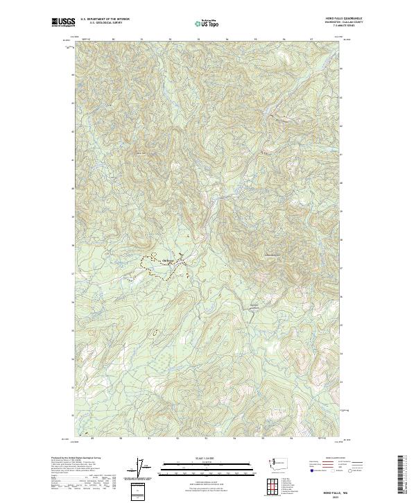
2023 Map of Hoko Falls
USGS Topo · Published 2023About this map
Old Royal sits along a bend in the Hoko River, serving as a focal point in this heavily forested landscape of the western Olympic Peninsula. The terrain is defined by significant elevations like Sekiu Mtn and Stolzenburg Mtn, which belong to the broader Olympic Mountains range. Numerous waterways, including Big River and the South Fork Sekiu River, carve through the deep drainages and canyons. The map details a network of logging and access routes such as the Hoko Ozette Rd and the 7000 Rd, reflecting the region's managed forest economy. Notable natural features like Herman Falls and the steep walls of Blue Canyon illustrate the dramatic shifts in elevation that characterize this part of Clallam County.
Find a feature on this map
27 named features on this map. Tap any name to fly to it.
Don’t see what you’re looking for? This feature index may not catch every label — zoom into the map to look around manually.
Map Details
Editions of this 2023 Hoko Falls Map
This is the sole edition of this map. No revisions or reprints were ever made.
Other maps of this area

1935 · Clallam
USGS Topo · 1:62,500

1935 · Ozette Lake
USGS Topo · 1:62,500

1935 · Lake Pleasant
USGS Topo · 1:62,500

1938 · Cape Flattery
USGS Topo · 1:62,500

1942 · Clallam
USGS Topo · 1:62,500

1942 · Ozette Lake
USGS Topo · 1:62,500

1942 · Lake Pleasant
USGS Topo · 1:62,500

1953 · Cape Flattery
USGS Topo · 1:250,000

1956 · Ozette Lake
USGS Topo · 1:62,500

1957 · Lake Pleasant
USGS Topo · 1:62,500