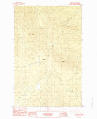
1984 Map of Hoko Falls
USGS Topo · Published 1984About this map
The Hoko River drainage defines the interior of the Clallam County timberlands during the early 1980s, revealing a landscape deeply marked by industrial forestry. Settlement patterns are sparse, characterized by worker outposts and small clearings such as Old Royal and Hoko Camp, while the broader terrain remains dominated by the elevations of Sekiu Mountain and Stolzenberg Mountain. The map provides a detailed view of the regional logistics of the era, illustrating how earlier infrastructure influenced later development.
Find a feature on this map
21 named features on this map. Tap any name to fly to it.
Don’t see what you’re looking for? This feature index may not catch every label — zoom into the map to look around manually.
Map Details
Editions of this 1984 Hoko Falls Map
This is the sole edition of this map. No revisions or reprints were ever made.
Other maps of this area

1935 · Clallam
USGS Topo · 1:62,500

1935 · Ozette Lake
USGS Topo · 1:62,500

1935 · Lake Pleasant
USGS Topo · 1:62,500

1938 · Cape Flattery
USGS Topo · 1:62,500

1942 · Clallam
USGS Topo · 1:62,500

1942 · Ozette Lake
USGS Topo · 1:62,500

1942 · Lake Pleasant
USGS Topo · 1:62,500

1953 · Cape Flattery
USGS Topo · 1:250,000

1956 · Ozette Lake
USGS Topo · 1:62,500

1957 · Lake Pleasant
USGS Topo · 1:62,500