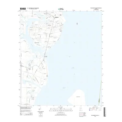
2014 Map of Hollingers Island
USGS Topo · Published 2014About this map
Mobile and its southern coastal suburbs meet the water on the western shore of Mobile Bay, where residential developments like Sherwood and Gulf Dale transition into the marshy complex of the Mobile River delta. The landscape is defined by its intricate hydrography, featuring the wide mouth of the Dog River and the branching reaches of Alligator Bayou and the N Fork Deer River. Human intervention in the bay is clearly marked by the Mobile Ship Channel and the Hollingers Island Channel, facilitating maritime traffic past the massive Gaillard Island. For local historians and genealogists, the map preserves the locations of the Lartigue Cem near the Mobile Downtown Airport and the Casher Cem in the heart of Clarke Gardens, alongside civil engineering landmarks like the John Roberts Peavy Bridge.
Find a feature on this map
96 named features on this map. Tap any name to fly to it.
Don’t see what you’re looking for? This feature index may not catch every label — zoom into the map to look around manually.
Map Details
Editions of this 2014 Hollingers Island Map
This is the sole edition of this map. No revisions or reprints were ever made.
Other maps of this area

1921 · Point Clear
USGS Topo · 1:62,500

1921 · Fairhope
USGS Topo · 1:62,500

1921 · Delchamps
USGS Topo · 1:62,500

1922 · Mobile
USGS Topo · 1:62,500

1939 · Daphne
USGS Topo · 1:31,680

1940 · Hollingers Island
USGS Topo · 1:31,680

1940 · Mobile
USGS Topo · 1:31,680

1940 · Mobile
USGS Topo · 1:62,500

1941 · Daphne
USGS Topo · 1:31,680

1941 · Cedar Point
USGS Topo · 1:62,500