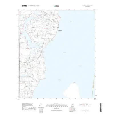
2020 Map of Hollingers Island
USGS Topo · Published 2020About this map
The western shores of Mobile Bay define this coastal landscape, where the Dog River and its complex network of tributaries meet the tide. This survey documents the developed residential corridors of Mobile and the southern settlement of Hollingers Island, reflecting the area's modern infrastructure and established neighborhoods. Notable aviation history is anchored by the Mobile Downtown Airport situated near the head of Robinson Bayou.
Find a feature on this map
110 named features on this map. Tap any name to fly to it.
Don’t see what you’re looking for? This feature index may not catch every label — zoom into the map to look around manually.
Map Details
Editions of this 2020 Hollingers Island Map
This is the sole edition of this map. No revisions or reprints were ever made.
Other maps of this area

1921 · Point Clear
USGS Topo · 1:62,500

1921 · Fairhope
USGS Topo · 1:62,500

1921 · Delchamps
USGS Topo · 1:62,500

1922 · Mobile
USGS Topo · 1:62,500

1939 · Daphne
USGS Topo · 1:31,680

1940 · Hollingers Island
USGS Topo · 1:31,680

1940 · Mobile
USGS Topo · 1:31,680

1940 · Mobile
USGS Topo · 1:62,500

1941 · Daphne
USGS Topo · 1:31,680

1941 · Cedar Point
USGS Topo · 1:62,500