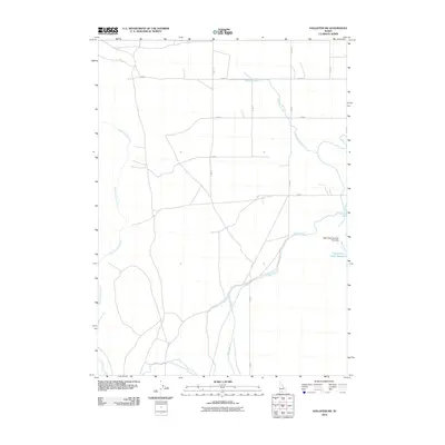
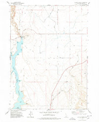
2010 Map of Hollister SW
USGS Topo · Published 2010About this map
Salmon Falls Creek winds through this agricultural landscape in Twin Falls County, defining the western drainage of a region shaped by modern irrigation efforts. The 2010 landscape is heavily organized by a grid of rural roads, including N 2000 E and E 2500 N, which support the farming operations that dominate this high desert area. To the east, the Main Canal serves as a vital artery for water distribution, feeding into the Lower Deep Creek Reservoir. This reservoir is managed by the Deep Creek Number One Dam, a critical piece of local infrastructure that regulates seasonal flow for the surrounding fields. Tributaries like Milligan Creek and Deep Creek provide further hydrological detail, showing how natural watercourses and man-made channels intersect to make the Idaho plains productive for local growers.
Find a feature on this map
14 named features on this map. Tap any name to fly to it.
Don’t see what you’re looking for? This feature index may not catch every label — zoom into the map to look around manually.
Map Details
Editions of this 2010 Hollister SW Map
This is the sole edition of this map. No revisions or reprints were ever made.
Other maps of this area

1955 · Twin Falls
USGS Topo · 1:250,000

1958 · Twin Falls
USGS Topo · 1:250,000
1965 · Hollister SW
USGS Topo · 1:24,000
1965 · Roseworth SE
USGS Topo · 1:24,000
1965 · Roseworth NE
USGS Topo · 1:24,000
1965 · Hollister
USGS Topo · 1:24,000
1965 · Berger
USGS Topo · 1:24,000
1965 · Berger Butte
USGS Topo · 1:24,000
1977 · Rogerson
USGS Topo · 1:24,000
1977 · Salmon Butte
USGS Topo · 1:24,000