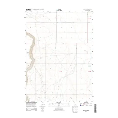
2013 Map of Hollister SW
USGS Topo · Published 2013About this map
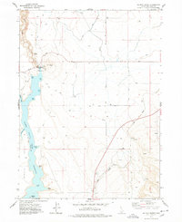
Salmon Falls Cr carves a deep path through the western edge of this Idaho high desert landscape, defining the topography of the region. The map captures the sophisticated water management systems essential to the agricultural development of the Snake River Plain, highlighted by the presence of the Main Canal and its intricate network of irrigation channels. In the east, the Lower Deep Cr Reservoir serves as a critical storage point where Deep Creek is managed for downstream use. The terrain is characterized by broad plateaus and isolated landmarks like Antelope Pocket, showing the balance between the natural arid environment and the human-engineered infrastructure that transformed southern Idaho's desert into productive land.
Find a feature on this map
5 named features on this map. Tap any name to fly to it.
Don’t see what you’re looking for? This feature index may not catch every label — zoom into the map to look around manually.
Map Details
Editions of this 2013 Hollister SW Map
This is the sole edition of this map. No revisions or reprints were ever made.
Other maps of this area

1955 · Twin Falls
USGS Topo · 1:250,000

1958 · Twin Falls
USGS Topo · 1:250,000
1965 · Hollister SW
USGS Topo · 1:24,000
1965 · Roseworth SE
USGS Topo · 1:24,000
1965 · Roseworth NE
USGS Topo · 1:24,000
1965 · Hollister
USGS Topo · 1:24,000
1965 · Berger
USGS Topo · 1:24,000
1965 · Berger Butte
USGS Topo · 1:24,000
1977 · Rogerson
USGS Topo · 1:24,000
1977 · Salmon Butte
USGS Topo · 1:24,000