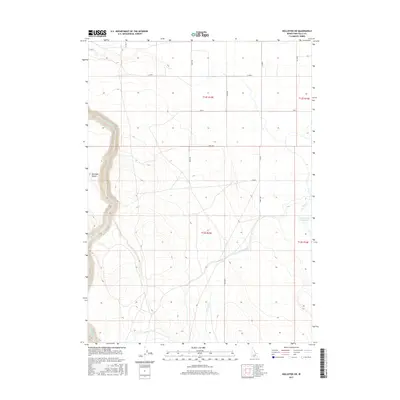
2017 Map of Hollister SW
USGS Topo · Published 2017About this map
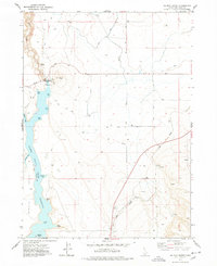
Salmon Falls Cr carves a deep canyon through the western edge of this agricultural landscape in Twin Falls County. The map details a sophisticated network of water management, centered around the Main Canal and the Lower Deep Cr Reservoir, which support the high desert farming community. The terrain is marked by the distinct depression of Antelope Pocket, providing a stark contrast to the surrounding gridded section lines. The presence of numerous designated roads like 1800 E Rd and 2300 N Rd illustrates the township and range system that organized the settlement and development of these Idaho plains. While largely rural, the confluence of Deep Cr and its associated reservoir indicates the vital importance of irrigation and water storage in this region.
Find a feature on this map
19 named features on this map. Tap any name to fly to it.
Don’t see what you’re looking for? This feature index may not catch every label — zoom into the map to look around manually.
Map Details
Editions of this 2017 Hollister SW Map
This is the sole edition of this map. No revisions or reprints were ever made.
Other maps of this area

1955 · Twin Falls
USGS Topo · 1:250,000

1958 · Twin Falls
USGS Topo · 1:250,000
1965 · Hollister SW
USGS Topo · 1:24,000
1965 · Roseworth SE
USGS Topo · 1:24,000
1965 · Roseworth NE
USGS Topo · 1:24,000
1965 · Hollister
USGS Topo · 1:24,000
1965 · Berger
USGS Topo · 1:24,000
1965 · Berger Butte
USGS Topo · 1:24,000
1977 · Rogerson
USGS Topo · 1:24,000
1977 · Salmon Butte
USGS Topo · 1:24,000