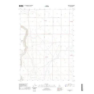
2020 Map of Hollister SW
USGS Topo · Published 2020About this map
Salmon Falls Cr carves a deep path through the western portion of this high desert terrain in Twin Falls County, defining the drainage patterns for this section of the Snake River Plain. The agricultural infrastructure that supports this region is evident in the presence of the Main Canal, which cuts across the southern township, and the Lower Deep Cr Reservoir to the east. These water management systems are essential to the modern ranching and farming operations that occupy the land between Deep Cr and the topographical depression known as Antelope Pocket. A precise grid of section lines and rural roads, including 1800 East Rd and 2400 N, organizes the landscape into distinct townships and ranges, reflecting the enduring legacy of the Public Land Survey System in Southern Idaho.
Find a feature on this map
19 named features on this map. Tap any name to fly to it.
Don’t see what you’re looking for? This feature index may not catch every label — zoom into the map to look around manually.
Map Details
Editions of this 2020 Hollister SW Map
This is the sole edition of this map. No revisions or reprints were ever made.
Other maps of this area

1955 · Twin Falls
USGS Topo · 1:250,000

1958 · Twin Falls
USGS Topo · 1:250,000

1965 · Hollister SW
USGS Topo · 1:24,000

1965 · Roseworth SE
USGS Topo · 1:24,000

1965 · Roseworth NE
USGS Topo · 1:24,000

1965 · Hollister
USGS Topo · 1:24,000

1965 · Berger
USGS Topo · 1:24,000

1965 · Berger Butte
USGS Topo · 1:24,000

1977 · Rogerson
USGS Topo · 1:24,000

1977 · Salmon Butte
USGS Topo · 1:24,000