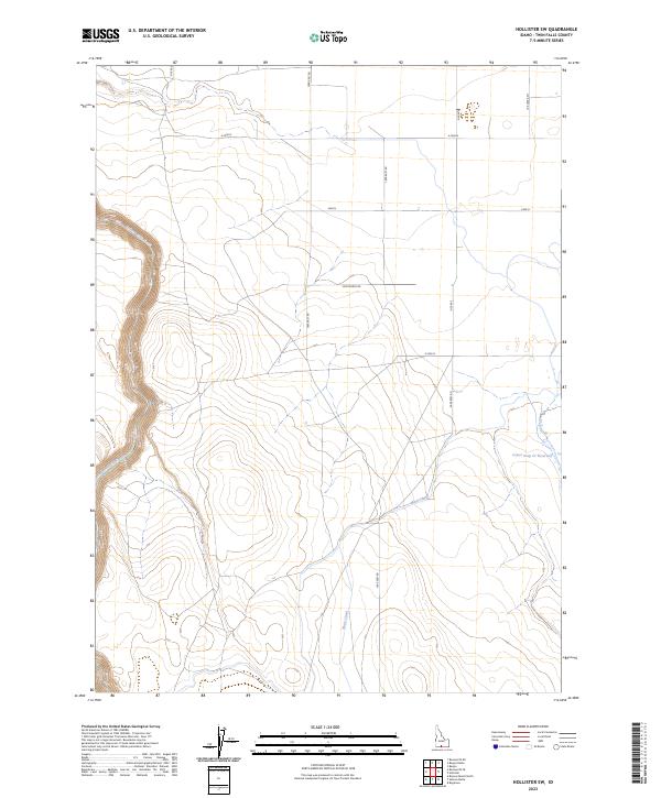
2023 Map of Hollister SW
USGS Topo · Published 2023About this map
Salmon Falls Creek cuts a distinct course through this section of Idaho's high desert, illustrating the sophisticated water management systems required for agriculture in Twin Falls County. The topographic data reveals a landscape defined by both natural drainage and human engineering, notably the Main Canal which traverses the southern terrain. This survey details the intersection of early 21st-century irrigation and the historic Public Land Survey System, with township lines like t12s r15e and t13s r16e organizing the grid. The northeastern corner is anchored by the Lower Deep Cr Reservoir, where Deep Creek flows through the sagebrush plains. A strictly partitioned network of rural routes, such as 1800 East Rd and E 2500 N, provides the framework for the region's vast ranching and farming tracts.
Find a feature on this map
18 named features on this map. Tap any name to fly to it.
Don’t see what you’re looking for? This feature index may not catch every label — zoom into the map to look around manually.
Map Details
Editions of this 2023 Hollister SW Map
This is the sole edition of this map. No revisions or reprints were ever made.
Other maps of this area

1955 · Twin Falls
USGS Topo · 1:250,000

1958 · Twin Falls
USGS Topo · 1:250,000

1965 · Hollister SW
USGS Topo · 1:24,000

1965 · Roseworth SE
USGS Topo · 1:24,000

1965 · Roseworth NE
USGS Topo · 1:24,000

1965 · Hollister
USGS Topo · 1:24,000

1965 · Berger
USGS Topo · 1:24,000

1965 · Berger Butte
USGS Topo · 1:24,000

1977 · Rogerson
USGS Topo · 1:24,000

1977 · Salmon Butte
USGS Topo · 1:24,000