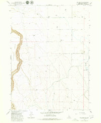
1979 Map of Hollister SW
USGS Topo · Published 1980About this map
Salmon Falls Creek carves a significant canyon through the high plateau of Twin Falls County, defining the western portion of this 1970s landscape. This survey captures a rural environment structured by water management, where the Main Canal and a Siphon facilitate the movement of resources across the arid terrain toward the Lower Deep Creek Res. The map illustrates the practical infrastructure of the high desert, from the sheltered Antelope Pocket to numerous dispersed Water Tanks and a solitary Corral that support the region's ranching and livestock heritage. Evidence of local industry is visible along North Road, where several Gravel Pits suggest the ongoing maintenance of the area's transportation network. This map provides researchers with a clear view of how irrigation and land use transformed the Snake River Plain periphery.
Find a feature on this map
12 named features on this map. Tap any name to fly to it.
Don’t see what you’re looking for? This feature index may not catch every label — zoom into the map to look around manually.
Map Details
Editions of this 1979 Hollister SW Map
This is the sole edition of this map. No revisions or reprints were ever made.
Other maps of this area

1955 · Twin Falls
USGS Topo · 1:250,000

1958 · Twin Falls
USGS Topo · 1:250,000

1965 · Hollister SW
USGS Topo · 1:24,000

1965 · Roseworth SE
USGS Topo · 1:24,000

1965 · Roseworth NE
USGS Topo · 1:24,000

1965 · Hollister
USGS Topo · 1:24,000

1965 · Berger
USGS Topo · 1:24,000

1965 · Berger Butte
USGS Topo · 1:24,000

1977 · Rogerson
USGS Topo · 1:24,000

1977 · Salmon Butte
USGS Topo · 1:24,000