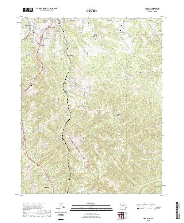
2021 Map of Hollister
USGS Topo · Published 2021About this map
Branson and Hollister serve as the primary hubs in this modern survey of Taney County, Missouri, where the landscape is defined by the steep relief of the Ozark Plateau. Aviation infrastructure is prominent, with the M Graham Clark Downtown Airport near the College of the Ozarks campus and the larger Branson Airport situated to the south. The topographic detail reveals a highly dissected terrain of ridges and deep drainage basins, including named hollows such as Coalpit Hollow, Happy Hollow, and McGill Hollow.
Find a feature on this map
102 named features on this map. Tap any name to fly to it.
Don’t see what you’re looking for? This feature index may not catch every label — zoom into the map to look around manually.
Map Details
Editions of this 2021 Hollister Map
This is the sole edition of this map. No revisions or reprints were ever made.
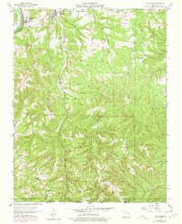
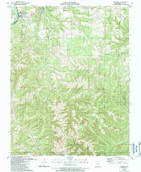
Historical Maps of Melva Through Time
3 maps found