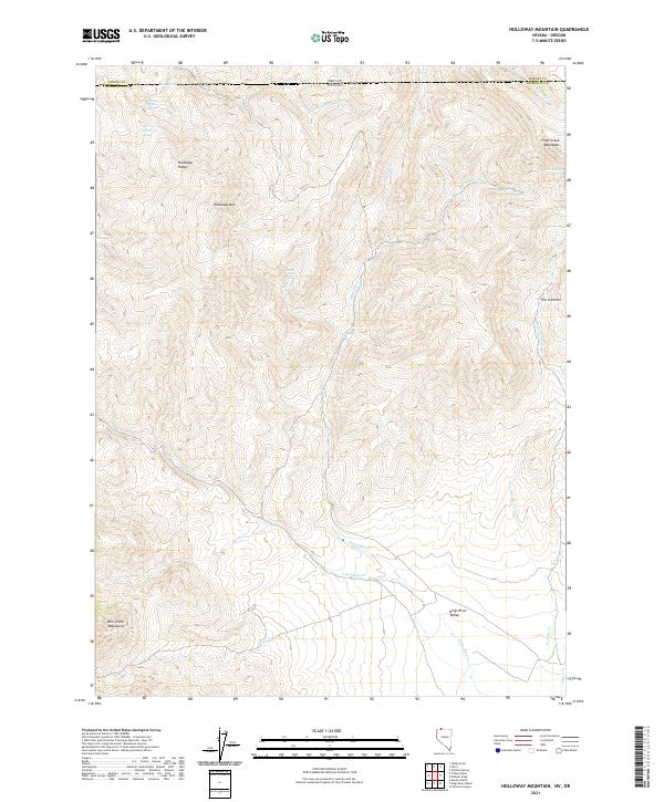
2021 Map of Holloway Mountain
USGS Topo · Published 2021About this map
The Holloway Mtn summit dominates the northwestern landscape of this remote borderland where Oregon and Nevada meet. This high-desert terrain is defined by its vital water sources, including the cluster of Sage Spring, Cherry Patch Spring, and Holloway Spring that lie near the Holloway Ridge. The eastern half of the map is shaped by the Kings River, which flows through the Kings River Valley between the Trout Creek Mountains and The Granites. The absence of named settlements or improved roads underscores the isolation of this ranching and grazing country, where survival has long depended on seasonal drainages like Cottonwood Cr and Log Cabin Cr. Topographical details reveal a complex network of canyons and peaks, including the northern edge of the Bilk Creek Mountains, providing a detailed look at the geographic character of the Humboldt and Harney County line.
Find a feature on this map
30 named features on this map. Tap any name to fly to it.
Don’t see what you’re looking for? This feature index may not catch every label — zoom into the map to look around manually.
Map Details
Editions of this 2021 Holloway Mountain Map
This is the sole edition of this map. No revisions or reprints were ever made.
Other maps of this area

1886 · Disaster
USGS Topo · 1:250,000

1893 · Disaster
USGS Topo · 1:250,000

1954 · Vya
USGS Topo · 1:250,000

1955 · Adel
USGS Topo · 1:250,000

1957 · Adel
USGS Topo · 1:250,000

1958 · Vya
USGS Topo · 1:250,000

1958 · Adel
USGS Topo · 1:250,000

1961 · Trident Peak
USGS Topo · 1:62,500

1961 · Disaster Peak
USGS Topo · 1:62,500

1962 · Vya
USGS Topo · 1:250,000