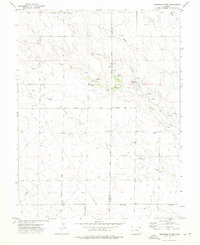
1973 Map of Holtwold Store
USGS Topo · Published 1976About this map
Holtwold Store stands as a focal point in this high-plains landscape, situated along the County Line between El Paso and Elbert Counties. The terrain is defined by a series of drainages, most notably the North Fork Horse Creek and Little Horse Creek, which carve subtle valleys across the plateau. The placement of Deadman Reservoir and Cutler Reservoir highlights the importance of water management in this arid cattle-ranching region during the early 1970s.
Find a feature on this map
23 named features on this map. Tap any name to fly to it.
Don’t see what you’re looking for? This feature index may not catch every label — zoom into the map to look around manually.
Map Details
Editions of this 1973 Holtwold Store Map
This is the sole edition of this map. No revisions or reprints were ever made.
Other maps of this area

1889 · Sanborn
USGS Topo · 1:125,000

1891 · Sanborn
USGS Topo · 1:125,000

1891 · Limon
USGS Topo · 1:125,000

1892 · Limon
USGS Topo · 1:125,000

1893 · Sanborn
USGS Topo · 1:125,000

1893 · Big Springs
USGS Topo · 1:125,000

1953 · Denver
USGS Topo · 1:250,000

1954 · Limon
USGS Topo · 1:250,000

1954 · Lamar
USGS Topo · 1:250,000

1954 · Pueblo
USGS Topo · 1:250,000