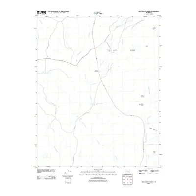
2010 Map of Holy Ghost Spring
USGS Topo · Published 2010About this map
CCC Camp Number 8N stands as a notable landmark in this arid New Mexico landscape, marking a legacy of public works along the drainage of the Rio Salado. The region is defined by its complex network of seasonal watercourses, including Arroyo Lopez and Arroyo Semilla, which feed into the larger Rio Puerco system. Mineral exploration is a primary characteristic of the area's development, evidenced by the cluster of mining operations like the Kaseman Number One Mine and the Warm Springs Mine located in the eastern portion of the quadrangle.
Find a feature on this map
31 named features on this map. Tap any name to fly to it.
Don’t see what you’re looking for? This feature index may not catch every label — zoom into the map to look around manually.
Map Details
Editions of this 2010 Holy Ghost Spring Map
This is the sole edition of this map. No revisions or reprints were ever made.
Other maps of this area

1883 · Mt. Taylor
USGS Topo · 1:250,000

1886 · Mt. Taylor
USGS Topo · 1:250,000

1890 · Jemes
USGS Topo · 1:125,000

1892 · Jemes
USGS Topo · 1:125,000

1892 · Mt. Taylor
USGS Topo · 1:250,000

1899 · Mt. Taylor
USGS Topo · 1:250,000

1939 · La Ventana
USGS Topo · 1:62,500

1939 · San Ysidro
USGS Topo · 1:62,500

1943 · San Ysidro
USGS Topo · 1:62,500

1943 · La Ventana
USGS Topo · 1:62,500