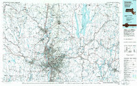
1985 Map of Holyoke
USGS Topo · Published 1986About this map
The Connecticut River serves as the central artery of this mid-1980s regional study, which documents the industrial and residential corridors of the Pioneer Valley. Significant urbanization is evident in the dense street grids of Holyoke, Springfield, and Chicopee, while the surrounding hill towns like Westhampton and Pelham maintain their rural character. The map captures the massive footprint of the Quabbin Reservoir to the east and the aviation infrastructure at Westover Air Force Base. Transportation networks are heavily detailed, including the Boston and Maine Railroad and the intersection of Interstate 91 with Interstate 90. This planimetric representation focuses on the manmade features of the era, from the sprawling state forests like October Mountain State Forest to the municipal reservoirs that define the regional watershed.
Find a feature on this map
185 named features on this map. Tap any name to fly to it.
Don’t see what you’re looking for? This feature index may not catch every label — zoom into the map to look around manually.
Map Details
Editions of this 1985 Holyoke Map
2 editions found
Other maps of this area

1885 · Northampton
USGS Topo · 1:62,500

1885 · Worcester
USGS Topo · 1:62,500

1886 · Greylock
USGS Topo · 1:62,500

1886 · Springfield
USGS Topo · 1:62,500

1886 · Hawley
USGS Topo · 1:62,500

1886 · Chesterfield
USGS Topo · 1:62,500

1886 · Worcester
USGS Topo · 1:62,500

1886 · Northampton
USGS Topo · 1:62,500

1886 · Becket
USGS Topo · 1:62,500

1887 · Brookfield
USGS Topo · 1:62,500