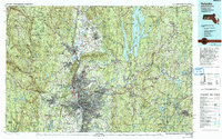
1985 Map of Holyoke
USGS Topo · Published 1993About this map
The Connecticut River serves as the central artery for this industrial and academic corridor, cutting through the distinctive geology of the Holyoke Range and the Mount Tom Range. During the mid-1980s, the urban centers of Springfield, Holyoke, and Chicopee show the dense infrastructure of the Pioneer Valley, supported by major rail lines like the Boston and Maine RR and the Central Vermont Ry. This map highlights the contrast between the heavily populated river cities and the expansive wilderness of the Quabbin Reservoir, a critical water resource managed within the Quabbin Reservoir State Park. Further north, the presence of Amherst and Northampton indicates the region's long-standing educational and cultural importance. To the west, the landscape shifts toward the high elevations of the Berkshires, marked by numerous managed lands such as Granville State Forest and Chester-Blandford State Forest. The inclusion of Westover Air Force Base underscores the strategic military and aviation footprint present in Ludlow and Chicopee during the late Cold War era.
Find a feature on this map
144 named features on this map. Tap any name to fly to it.
Don’t see what you’re looking for? This feature index may not catch every label — zoom into the map to look around manually.
Map Details
Editions of this 1985 Holyoke Map
2 editions found
Other maps of this area

1885 · Northampton
USGS Topo · 1:62,500

1885 · Worcester
USGS Topo · 1:62,500

1886 · Greylock
USGS Topo · 1:62,500

1886 · Springfield
USGS Topo · 1:62,500

1886 · Hawley
USGS Topo · 1:62,500

1886 · Chesterfield
USGS Topo · 1:62,500

1886 · Worcester
USGS Topo · 1:62,500

1886 · Northampton
USGS Topo · 1:62,500

1886 · Becket
USGS Topo · 1:62,500

1887 · Brookfield
USGS Topo · 1:62,500