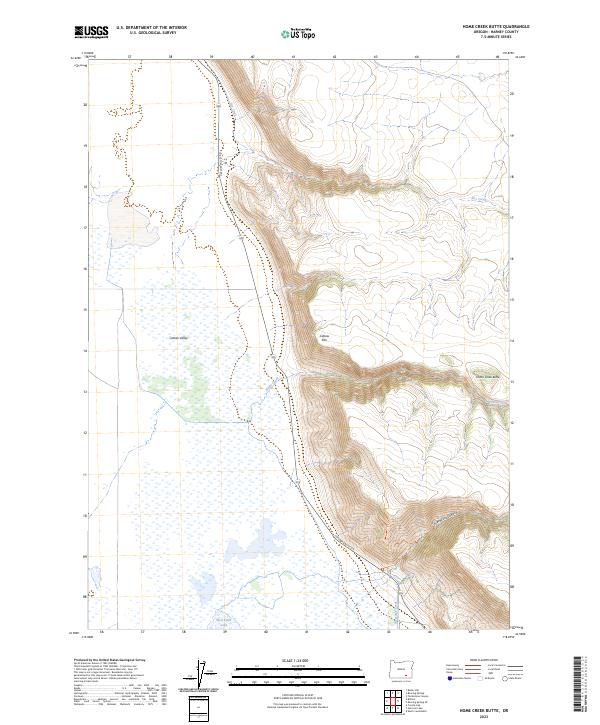
2023 Map of Home Creek Butte
USGS Topo · Published 2023About this map
Catlow Rim serves as a dramatic geologic boundary on this Harney County landscape, separating the high desert plateau from the expansive Catlow Valley below. This survey captures a remote section of the Steens Mountain Wilderness in the northeast, where the elevation rises sharply toward Home Creek Butte. The map illustrates the hydrology of this arid region, showing how seasonal drainages like Home Creek and Threemile Creek emerge from deep incisions such as Threemile Canyon before reaching the valley floor. Evidence of human passage and land management is preserved through the alignment of Catlow Valley Rd and the Threemile Trail, while the presence of West Field Lake suggests the intermittent basins that define the local topography.
Find a feature on this map
15 named features on this map. Tap any name to fly to it.
Don’t see what you’re looking for? This feature index may not catch every label — zoom into the map to look around manually.
Map Details
Editions of this 2023 Home Creek Butte Map
This is the sole edition of this map. No revisions or reprints were ever made.
Other maps of this area

1955 · Adel
USGS Topo · 1:250,000

1957 · Adel
USGS Topo · 1:250,000

1958 · Adel
USGS Topo · 1:250,000

1962 · Adel
USGS Topo · 1:250,000

1967 · Roaring Springs
USGS Topo · 1:24,000

1968 · Tombstone Canyon
USGS Topo · 1:24,000

1968 · Roaring Springs SE
USGS Topo · 1:24,000

1971 · Blitzen
USGS Topo · 1:24,000

1971 · Garrison Lake
USGS Topo · 1:24,000

1971 · Butler Hill
USGS Topo · 1:24,000