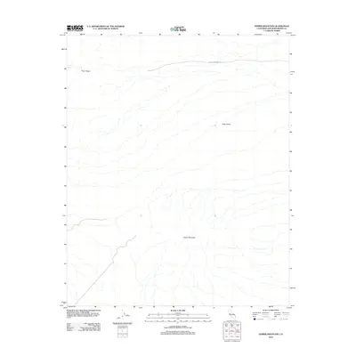
2012 Map of Homer Mountain
USGS Topo · Published 2012About this map
Homer Mountain rises as the central topographic feature in this corner of the Mojave Desert, overseeing a landscape defined by dramatic elevation changes and essential desert water sources. The presence of Piute Spring near the Piute Range highlights a critical point of survival in this arid environment, historically serving as a waypoint for travelers and wildlife alike. Traversing the northern portion of the quadrangle, the Old Government Rd represents a historic corridor of movement through the Piute Valley, marking a transition from early desert trails to the established paths of the modern era. This 2012 survey illustrates the relationship between these natural landforms and the human attempts to navigate the high-desert terrain of San Bernardino County.
Find a feature on this map
5 named features on this map. Tap any name to fly to it.
Don’t see what you’re looking for? This feature index may not catch every label — zoom into the map to look around manually.
Map Details
Editions of this 2012 Homer Mountain Map
This is the sole edition of this map. No revisions or reprints were ever made.
Other maps of this area

1886 · Camp Mohave
USGS Topo · 1:250,000

1892 · Camp Mohave
USGS Topo · 1:250,000

1910 · Ivanpah
USGS Topo · 1:250,000

1912 · Ivanpah
USGS Topo · 1:250,000

1926 · Mohave City
USGS Topo · 1:96,000

1942 · Camp Mohave
USGS Topo · 1:250,000

1942 · Ivanpah
USGS Topo · 1:250,000

1942 · Amboy
USGS Topo · 1:250,000

1943 · Amboy
USGS Topo · 1:250,000

1943 · Fenner
USGS Topo · 1:62,500