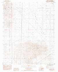
1984 Map of Homer Mtn
USGS Topo · Published 1984About this map
Fort Piute (Ruins) and nearby Petroglyphs offer a look at the historical layers of this San Bernardino County landscape. Located within the East Mojave National Scenic Area, the map documents the critical intersection of water and travel in the high desert, centered around Piute Spring. This water source was a vital stop along the historic Government Road, which cuts through the Piute Range to connect the desert basins.
Find a feature on this map
19 named features on this map. Tap any name to fly to it.
Don’t see what you’re looking for? This feature index may not catch every label — zoom into the map to look around manually.
Map Details
Editions of this 1984 Homer Mtn Map
This is the sole edition of this map. No revisions or reprints were ever made.
Other maps of this area

1886 · Camp Mohave
USGS Topo · 1:250,000

1892 · Camp Mohave
USGS Topo · 1:250,000

1910 · Ivanpah
USGS Topo · 1:250,000

1912 · Ivanpah
USGS Topo · 1:250,000

1926 · Mohave City
USGS Topo · 1:96,000

1942 · Camp Mohave
USGS Topo · 1:250,000

1942 · Ivanpah
USGS Topo · 1:250,000

1942 · Amboy
USGS Topo · 1:250,000

1943 · Amboy
USGS Topo · 1:250,000

1943 · Fenner
USGS Topo · 1:62,500