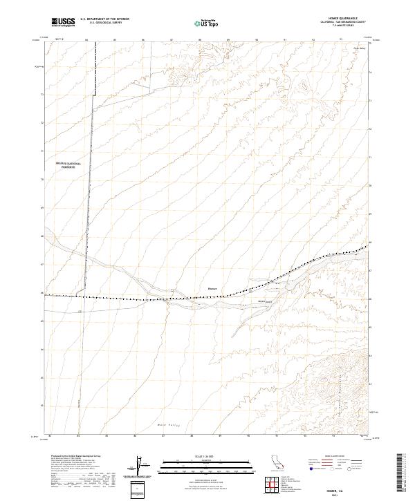
2021 Map of Homer
USGS Topo · Published 2021About this map
Homer marks a key point of interest in this high-desert landscape within the Mojave Desert. The map reveals a transition between prominent geological features, where the Sacramento Mountains rise to the southeast and the broad sweeps of Piute Valley and Ward Valley converge. Large portions of the western terrain are managed as part of the Mojave National Preserve, illustrating the modern balance of land use in San Bernardino County. A primary transportation corridor bisects the area, providing the historical and modern backbone for movement through this arid environment, while Walter Rd provides more localized access to the southwest. The grid-like Public Land Survey System divisions emphasize the administrative history of these expansive California desert lands.
Find a feature on this map
13 named features on this map. Tap any name to fly to it.
Don’t see what you’re looking for? This feature index may not catch every label — zoom into the map to look around manually.
Map Details
Editions of this 2021 Homer Map
This is the sole edition of this map. No revisions or reprints were ever made.
Other maps of this area

1886 · Camp Mohave
USGS Topo · 1:250,000

1892 · Camp Mohave
USGS Topo · 1:250,000

1910 · Ivanpah
USGS Topo · 1:250,000

1912 · Ivanpah
USGS Topo · 1:250,000

1926 · Mohave City
USGS Topo · 1:96,000

1942 · Camp Mohave
USGS Topo · 1:250,000

1942 · Ivanpah
USGS Topo · 1:250,000

1942 · Amboy
USGS Topo · 1:250,000

1943 · Amboy
USGS Topo · 1:250,000

1943 · Fenner
USGS Topo · 1:62,500