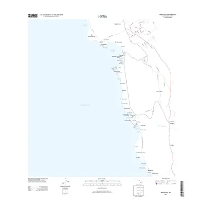
2013 Map of Honaunau
USGS Topo · Published 2013About this map
Kealakekua Bay anchors this coastal survey of the South Kona district, a landscape where ancient Hawaiian sacred sites meet the infrastructure of the early 21st century. The map highlights the significant cultural and religious heritage of the area, featuring Cooks Monument and Cooks Heliau at Ka'awaloa, alongside numerous traditional sites such as Hikiau Heiau and Hale o Keawe Heiau. This concentration of features within the Pu'uhonua O Honaunau National Historical Park illustrates the enduring importance of this shoreline as a place of refuge and ceremony.
Find a feature on this map
89 named features on this map. Tap any name to fly to it.
Don’t see what you’re looking for? This feature index may not catch every label — zoom into the map to look around manually.
Map Details
Editions of this 2013 Honaunau Map
This is the sole edition of this map. No revisions or reprints were ever made.
Other maps of this area

1928 · Kailua
USGS Topo · 1:62,500

1954 · Hawaii South
USGS Topo · 1:250,000

1954 · Hawaii North
USGS Topo · 1:250,000

1959 · Hawaii South
USGS Topo · 1:250,000

1959 · Hawaii North
USGS Topo · 1:250,000

1959 · Honaunau
USGS Topo · 1:24,000

1959 · Puu Lehua
USGS Topo · 1:24,000
1960 · Kaunene
USGS Topo · 1:24,000
1960 · Kealakekua
USGS Topo · 1:24,000

1961 · Hawaii North
USGS Topo · 1:250,000