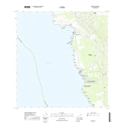
2017 Map of Honaunau
USGS Topo · Published 2017About this map
Captain Cook and the coastal settlements of Island of Hawai'i occupy a dramatic landscape defined by steep pali and historical shorelines. The coastal shelf is a dense corridor of cultural significance, anchored by Pu'uhonua O Hōnaunau National Historical Park and the Ala Kahakai National Historic Trail. These sites preserve the archaeological and spiritual legacy of the region, including features like Pali Kapu o Keoua and the ancient walls of the sanctuary at Hōnaunau Bay.
Find a feature on this map
62 named features on this map. Tap any name to fly to it.
Don’t see what you’re looking for? This feature index may not catch every label — zoom into the map to look around manually.
Map Details
Editions of this 2017 Honaunau Map
This is the sole edition of this map. No revisions or reprints were ever made.
Other maps of this area

1928 · Kailua
USGS Topo · 1:62,500

1954 · Hawaii South
USGS Topo · 1:250,000

1954 · Hawaii North
USGS Topo · 1:250,000

1959 · Hawaii South
USGS Topo · 1:250,000

1959 · Hawaii North
USGS Topo · 1:250,000

1959 · Honaunau
USGS Topo · 1:24,000

1959 · Puu Lehua
USGS Topo · 1:24,000
1960 · Kaunene
USGS Topo · 1:24,000
1960 · Kealakekua
USGS Topo · 1:24,000

1961 · Hawaii North
USGS Topo · 1:250,000