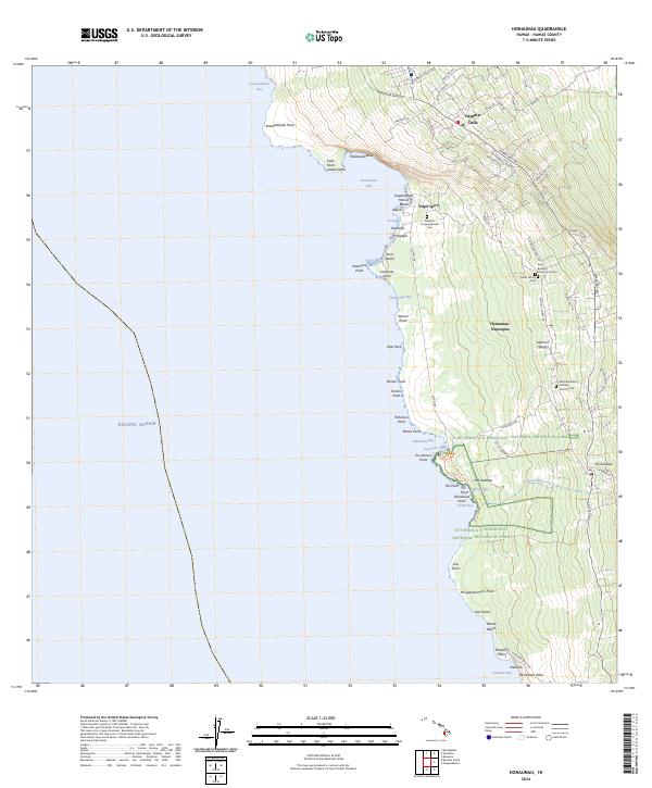
2024 Map of Honaunau
USGS Topo · Published 2024About this map
Pu‘uhonua O Hōnaunau National Historical Park anchors this coastal section of Hawaii County, preserving a landscape deeply rooted in Indigenous history. The map shows a transition from the rugged shoreline at Kealakekua Bay and Mokuakae Bay to the upland agricultural and residential corridors along the Hawaii Belt Rd. This region's diverse heritage is evident in its religious landmarks, ranging from the Keei Buddhist Church and Cem and the Saint Benedicts Catholic Church Cem to the Kahikolu Congregational Cem. The settlement pattern follows the steep terrain, with Captain Cook positioned at higher elevations while Nāpō‘opo‘o and Honaunau-Nāpoopoo occupy the coastline. A network of local paths, including the Coastal Trail, connects various points like Pu‘uhonua Point and Pali Alahaka, tracing the same coastal routes used for generations.
Find a feature on this map
81 named features on this map. Tap any name to fly to it.
Don’t see what you’re looking for? This feature index may not catch every label — zoom into the map to look around manually.
Map Details
Editions of this 2024 Honaunau Map
This is the sole edition of this map. No revisions or reprints were ever made.
Other maps of this area

1928 · Kailua
USGS Topo · 1:62,500

1954 · Hawaii South
USGS Topo · 1:250,000

1954 · Hawaii North
USGS Topo · 1:250,000

1959 · Hawaii South
USGS Topo · 1:250,000

1959 · Hawaii North
USGS Topo · 1:250,000

1959 · Honaunau
USGS Topo · 1:24,000

1959 · Puu Lehua
USGS Topo · 1:24,000
1960 · Kaunene
USGS Topo · 1:24,000
1960 · Kealakekua
USGS Topo · 1:24,000

1961 · Hawaii North
USGS Topo · 1:250,000