
1959 Map of Honaunau
USGS Topo · Published 1960About this map
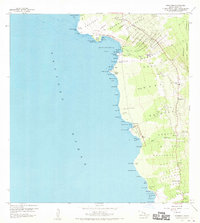
Kealakekua Bay serves as a focal point for this coastal survey of the South Kona district, where the historic Cooks Monument marks the shoreline near Kaawaloa. The landscape is a transition from the rugged basaltic coast to the upland agricultural zones, notably illustrated by the Coffee Mill above Napoopoo. This era shows a network of established settlements connected by a mix of roads and a Jeep Trail, supporting local industry and the Honaunau Forest Reserve. The map provides significant cultural detail at the City of Refuge National Historical Park near Honaunau, documenting the site's layout before later modern developments. Coastal features like Pali Kapu o Keoua and several named beaches such as Keei Beach and Kalahiki Beach define the western edge, while educational hubs like Hookena School and Napoopoo School reveal the distribution of the mid-century population.
Find a feature on this map
86 named features on this map. Tap any name to fly to it.
Don’t see what you’re looking for? This feature index may not catch every label — zoom into the map to look around manually.
Map Details
Editions of this 1959 Honaunau Map
2 editions found
Other maps of this area

1928 · Kailua
USGS Topo · 1:62,500

1954 · Hawaii South
USGS Topo · 1:250,000

1954 · Hawaii North
USGS Topo · 1:250,000

1959 · Hawaii South
USGS Topo · 1:250,000

1959 · Hawaii North
USGS Topo · 1:250,000

1959 · Puu Lehua
USGS Topo · 1:24,000
1960 · Kaunene
USGS Topo · 1:24,000
1960 · Kealakekua
USGS Topo · 1:24,000

1961 · Hawaii North
USGS Topo · 1:250,000

1961 · Hawaii South
USGS Topo · 1:250,000