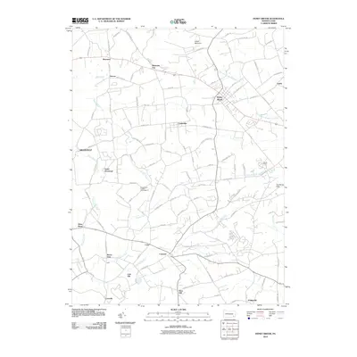
2010 Map of Honey Brook
USGS Topo · Published 2010About this map
Welsh Mountain anchors the northern skyline of this landscape where the headwaters of the West Branch Brandywine Creek and Pequea Creek diverge. The early 21st-century settlement pattern reflects a deeply rooted agricultural and rural community, with small villages like Honey Brook, Narvon, and Beartown serving as local hubs. This map reveals the intricate network of township roads—such as Wertztown Rd and Meadville Rd—that weave through the rolling fields of Lancaster and Chester Counties.
Find a feature on this map
96 named features on this map. Tap any name to fly to it.
Don’t see what you’re looking for? This feature index may not catch every label — zoom into the map to look around manually.
Map Details
Editions of this 2010 Honey Brook Map
This is the sole edition of this map. No revisions or reprints were ever made.
Other maps of this area

1904 · Coatesville
USGS Topo · 1:62,500

1905 · Honey Brook
USGS Topo · 1:62,500

1906 · Coatesville
USGS Topo · 1:62,500

1906 · New Holland
USGS Topo · 1:62,500

1907 · Honeybrook
USGS Topo · 1:62,500

1908 · New Holland
USGS Topo · 1:62,500

1912 · Quarryville
USGS Topo · 1:62,500

1918 · Coatesville
USGS Topo · 1:62,500

1941 · Honeybrook
USGS Topo · 1:62,500

1941 · New Holland
USGS Topo · 1:62,500
Featured Places
- East Earl Township, PA
- Honey Brook, PA
- Cains, Salisbury Township
- Suplee, Honey Brook Township
- Cole Hill, Salisbury Township