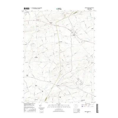
2016 Map of Honey Brook
USGS Topo · Published 2016About this map
Honey Brook serves as a central hub in this landscape where the boundaries of Lancaster Co and Chester Co meet. The area is defined by a dense network of historic settlements and rural road systems, with Welsh Mtn and The Baron Hills providing significant topographical relief against the surrounding agricultural valleys. The drainage patterns of the Pequea Cr and various branches of the W Br Brandywine Cr indicate the region's position as a headwaters area for several critical Pennsylvania watersheds. From Beartown and Goodville in the northwest to Suplee in the northeast, the map documents a transition from upland forest to productive farmland. Smaller communities like Cambridge, South Hermitage, and White Horse are linked by established thoroughfares such as Horse Shoe Pike, reflecting centuries of development in this part of the Dutch Country.
Find a feature on this map
139 named features on this map. Tap any name to fly to it.
Don’t see what you’re looking for? This feature index may not catch every label — zoom into the map to look around manually.
Map Details
Editions of this 2016 Honey Brook Map
This is the sole edition of this map. No revisions or reprints were ever made.
Other maps of this area

1904 · Coatesville
USGS Topo · 1:62,500

1905 · Honey Brook
USGS Topo · 1:62,500

1906 · Coatesville
USGS Topo · 1:62,500

1906 · New Holland
USGS Topo · 1:62,500

1907 · Honeybrook
USGS Topo · 1:62,500

1908 · New Holland
USGS Topo · 1:62,500

1912 · Quarryville
USGS Topo · 1:62,500

1918 · Coatesville
USGS Topo · 1:62,500

1941 · Honeybrook
USGS Topo · 1:62,500

1941 · New Holland
USGS Topo · 1:62,500
Featured Places
- East Earl Township, PA
- Honey Brook, PA
- Cains, Salisbury Township
- Suplee, Honey Brook Township
- Cole Hill, Salisbury Township