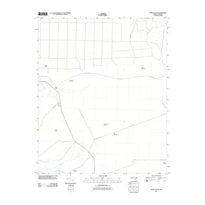
2010 Map of Honey Island
USGS Topo · Published 2010About this map
Honey Island and Moon Island anchor this coastal plain landscape in Brunswick County, defined by a network of drainage branches and distinctive savanna terrain. The region is marked by significant topographical features such as Rattlesnake Ridge and Riegel Ridge, which rise above the low-lying wetlands of First Cross Swamp and Boggy Branch. The spatial arrangement of the land reflects a traditional rural infrastructure, where long thoroughfares like Jerry Clemis Rd and Shackletown Rd connect scattered landmarks.
Find a feature on this map
25 named features on this map. Tap any name to fly to it.
Don’t see what you’re looking for? This feature index may not catch every label — zoom into the map to look around manually.
Map Details
Editions of this 2010 Honey Island Map
This is the sole edition of this map. No revisions or reprints were ever made.
Other maps of this area

1942 · Juniper Creek
USGS Topo · 1:24,000

1943 · Honey Island
USGS Topo · 1:24,000

1943 · Exum
USGS Topo · 1:24,000

1943 · Bolivia
USGS Topo · 1:24,000

1943 · Supply
USGS Topo · 1:24,000

1943 · Lewis Swamp
USGS Topo · 1:24,000

1944 · Supply
USGS Topo · 1:31,680

1944 · Bolivia
USGS Topo · 1:31,680

1944 · Lewis Swamp
USGS Topo · 1:31,680
1950 · Supply
USGS Topo · 1:25,000