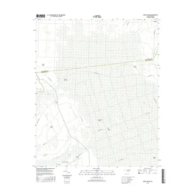
2016 Map of Honey Island
USGS Topo · Published 2016About this map
The low-lying wetlands of Brunswick and Columbus counties dominate this landscape, defined by an intricate network of savannas and named ridges. The Green Swamp extends across much of the territory, interrupted by higher ground such as Riegel Ridge and Rattlesnake Ridge. Small settlements like Prosper sit near the northern boundary, while the interior is largely occupied by vast hydrologic features including Honey Island Swamp, Egypt Swamp, and the First Cross Swamp.
Find a feature on this map
31 named features on this map. Tap any name to fly to it.
Don’t see what you’re looking for? This feature index may not catch every label — zoom into the map to look around manually.
Map Details
Editions of this 2016 Honey Island Map
This is the sole edition of this map. No revisions or reprints were ever made.
Other maps of this area

1942 · Juniper Creek
USGS Topo · 1:24,000

1943 · Honey Island
USGS Topo · 1:24,000

1943 · Exum
USGS Topo · 1:24,000

1943 · Bolivia
USGS Topo · 1:24,000

1943 · Supply
USGS Topo · 1:24,000

1943 · Lewis Swamp
USGS Topo · 1:24,000

1944 · Supply
USGS Topo · 1:31,680

1944 · Bolivia
USGS Topo · 1:31,680

1944 · Lewis Swamp
USGS Topo · 1:31,680
1950 · Supply
USGS Topo · 1:25,000