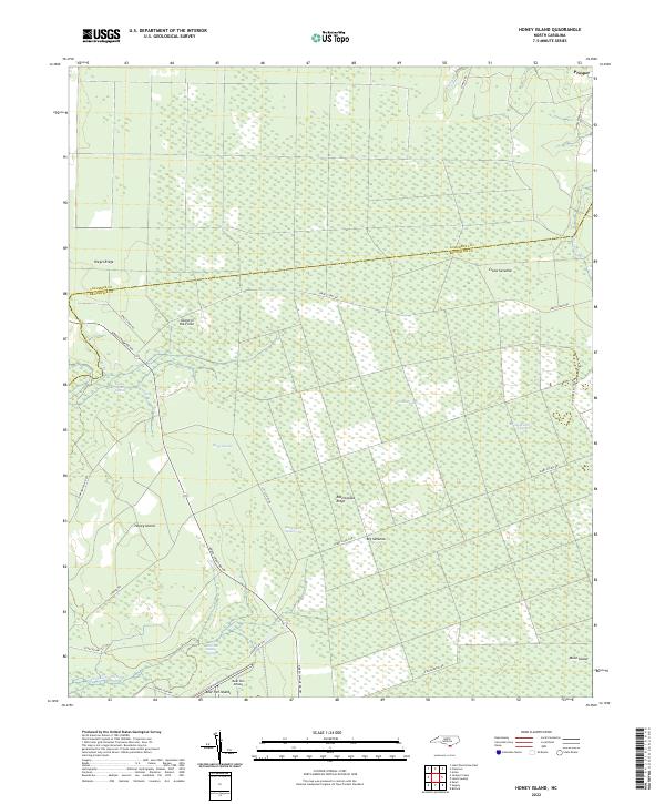
2022 Map of Honey Island
USGS Topo · Published 2022About this map
The Green Swamp dominates this landscape, defining a network of wetland systems and isolated higher ground in southern North Carolina. The small settlement of Prosper sits at the northern edge, while Honey Island and the Bear Pen Islands emerge as distinct landforms within the saturated surroundings. This map highlights the unique terrain of the Atlantic coastal plain, where vast grassy openings like Crane Savanna, Big Savanna, and the Ready Branch Opening break up the forested swamplands. These features, along with names like Riegel Ridge and Rattlesnake Ridge, indicate the importance of subtle elevation changes for habitation and transit in this region. Private aviation is represented by the Bear Pen Airport, while the boundary between Columbus Co and Brunswick Co cuts through the northern portion of the sheet. The road network, including Shackletown Rd and Jerry Clemis Rd, traces the edges of these hydrologic systems, providing access to the more stable ridges.
Find a feature on this map
34 named features on this map. Tap any name to fly to it.
Don’t see what you’re looking for? This feature index may not catch every label — zoom into the map to look around manually.
Map Details
Editions of this 2022 Honey Island Map
This is the sole edition of this map. No revisions or reprints were ever made.
Other maps of this area

1942 · Juniper Creek
USGS Topo · 1:24,000

1943 · Honey Island
USGS Topo · 1:24,000

1943 · Exum
USGS Topo · 1:24,000

1943 · Bolivia
USGS Topo · 1:24,000

1943 · Supply
USGS Topo · 1:24,000

1943 · Lewis Swamp
USGS Topo · 1:24,000

1944 · Supply
USGS Topo · 1:31,680

1944 · Bolivia
USGS Topo · 1:31,680

1944 · Lewis Swamp
USGS Topo · 1:31,680
1950 · Supply
USGS Topo · 1:25,000