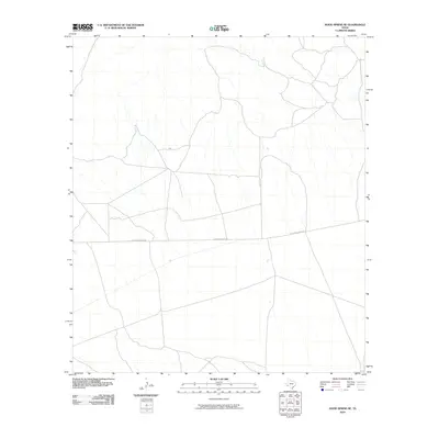
2010 Map of Hood Spring SE
USGS Topo · Published 2010About this map
Dove Mountain Rd provides the primary transit corridor across this arid expanse of Brewster County, where the desert floor is etched by a complex web of seasonal drainage channels. The landscape is defined by its subtle topographic shifts, with elevation contours from the National Elevation Dataset mapping the gradual rise and fall of the terrain. Sparse human development in this remote part of West Texas is evidenced by the limited road network, reflecting a region largely preserved for cattle ranching or conservation. The intricate hydrography shows numerous unnamed tributaries that likely only flow during brief, intense mountain rains, illustrating the environmental challenges and the specific water-drainage patterns unique to this pocket of the Trans-Pecos region.
Find a feature on this map
1 named feature on this map. Tap any name to fly to it.
Don’t see what you’re looking for? This feature index may not catch every label — zoom into the map to look around manually.
Map Details
Editions of this 2010 Hood Spring SE Map
This is the sole edition of this map. No revisions or reprints were ever made.
Other maps of this area

1917 · Bone Spring
USGS Topo · 1:62,500

1917 · Hood Spring
USGS Topo · 1:62,500

1918 · Bone Spring
USGS Topo · 1:125,000

1918 · Hood Spring
USGS Topo · 1:62,500

1918 · Dove Mountain
USGS Topo · 1:62,500

1918 · Bone Spring
USGS Topo · 1:62,500

1919 · Maravillas Canyon
USGS Topo · 1:62,500

1920 · Bone Spring
USGS Topo · 1:62,500

1931 · Hood Spring
USGS Topo · 1:62,500

1959 · Emory Peak
USGS Topo · 1:250,000