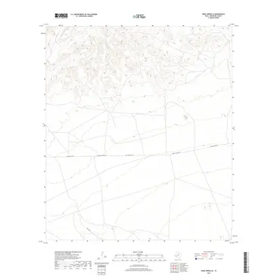
2019 Map of Hood Spring SE
USGS Topo · Published 2019About this map
High-altitude desert terrain in Brewster County characterizes this 2019 survey, where the landscape is defined by the steep relief of unnamed peaks and deep drainage basins. Human activity in this portion of the Trans-Pecos is limited to a sparse network of unpaved desert routes. The primary east-west corridor is Desert Mountain Rd, which transitions into Dove Mountain Rd as it traverses the lower elevations below the northern mountain complex. At the southern edge of the quadrangle, Dove Mt Rd angles through the valley, providing one of the few points of access to this remote region of West Texas. The topographic detail highlights the contrast between the heavily contoured ridges of the north and the broader alluvial plains to the south.
Find a feature on this map
3 named features on this map. Tap any name to fly to it.
Don’t see what you’re looking for? This feature index may not catch every label — zoom into the map to look around manually.
Map Details
Editions of this 2019 Hood Spring SE Map
This is the sole edition of this map. No revisions or reprints were ever made.
Other maps of this area

1917 · Bone Spring
USGS Topo · 1:62,500

1917 · Hood Spring
USGS Topo · 1:62,500

1918 · Bone Spring
USGS Topo · 1:125,000

1918 · Hood Spring
USGS Topo · 1:62,500

1918 · Dove Mountain
USGS Topo · 1:62,500

1918 · Bone Spring
USGS Topo · 1:62,500

1919 · Maravillas Canyon
USGS Topo · 1:62,500

1920 · Bone Spring
USGS Topo · 1:62,500

1931 · Hood Spring
USGS Topo · 1:62,500

1959 · Emory Peak
USGS Topo · 1:250,000