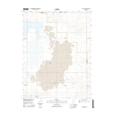
2015 Map of Hooten Well
USGS Topo · Published 2015About this map
Hooten Well sits at the base of the Dead Camel Mountains, anchoring a landscape defined by the intersection of historic transit corridors and modern water management. The map documents the arid expanse of Churchill Valley, where the historic Pony Express Route and the Simpson Rd trace the paths of early western migration across the desert floor. To the northwest, the influence of the Newlands Project is visible in the waters of the Lahontan Reservoir, which borders the rugged uplands. Moving south, the terrain rises into the Desert Mountains, illustrating the dramatic topographical shifts between the valley floor and the high ridges of Lyon and Churchill counties. This 2015 survey provides a modern topographical look at these long-standing geographic markers, where early ranching access roads like Pg Ranch Rd meet the engineered infrastructure of the Lahohtan Dam Rd.
Find a feature on this map
18 named features on this map. Tap any name to fly to it.
Don’t see what you’re looking for? This feature index may not catch every label — zoom into the map to look around manually.
Map Details
Editions of this 2015 Hooten Well Map
This is the sole edition of this map. No revisions or reprints were ever made.
Other maps of this area

1891 · Wabuska
USGS Topo · 1:125,000

1894 · Wabuska
USGS Topo · 1:125,000

1908 · Carson Sink
USGS Topo · 1:250,000

1910 · Carson Sink
USGS Topo · 1:250,000

1951 · Weber Reservoir
USGS Topo · 1:62,500

1951 · Fallon
USGS Topo · 1:62,500

1957 · Wabuska
USGS Topo · 1:62,500

1957 · Silver Springs
USGS Topo · 1:62,500

1957 · Reno
USGS Topo · 1:250,000

1959 · Reno
USGS Topo · 1:250,000