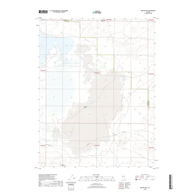
2018 Map of Hooten Well
USGS Topo · Published 2018About this map
The high desert landscape of Churchill and Lyon Counties is defined by the expansive Churchill Valley and the southern reaches of the Lahontan Reservoir. This terrain is historically significant for its role in western transit, most notably featuring a section of the Pony Express Rte which cuts through the southern portion of the quadrangle. The map details the transition between the Dead Camel Mountains to the north and the Desert Mountains to the south, highlighting the isolation of landmarks like Hooten Well. This specific well and the various desert tracks, including Simpson Rd, reflect the enduring importance of water sources and established paths in the Great Basin. The presence of the reservoir and Lahontan Dam Rd in the northwest corner provides a stark contrast between the natural arid topography and regional water management infrastructure.
Find a feature on this map
17 named features on this map. Tap any name to fly to it.
Don’t see what you’re looking for? This feature index may not catch every label — zoom into the map to look around manually.
Map Details
Editions of this 2018 Hooten Well Map
This is the sole edition of this map. No revisions or reprints were ever made.
Other maps of this area

1891 · Wabuska
USGS Topo · 1:125,000

1894 · Wabuska
USGS Topo · 1:125,000

1908 · Carson Sink
USGS Topo · 1:250,000

1910 · Carson Sink
USGS Topo · 1:250,000

1951 · Weber Reservoir
USGS Topo · 1:62,500

1951 · Fallon
USGS Topo · 1:62,500

1957 · Wabuska
USGS Topo · 1:62,500

1957 · Silver Springs
USGS Topo · 1:62,500

1957 · Reno
USGS Topo · 1:250,000

1959 · Reno
USGS Topo · 1:250,000