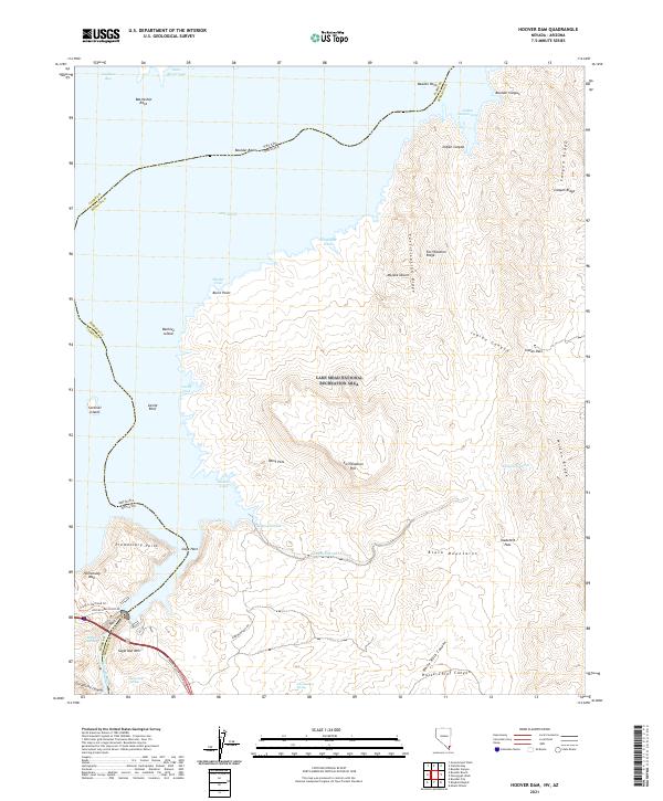
2021 Map of Hoover Dam
USGS Topo · Published 2021About this map
Lake Mead and its surrounding desert basins dominate this study of the borderlands between Clark County, Nevada, and Mohave County, Arizona. Located within the Lake Mead National Recreation Area, the landscape is defined by massive volcanic features and tectonic shifts, most notably Fortification Hill and the dark, jagged expanse of the Black Mountains. The reservoir's complex shoreline is marked by numerous indentations such as Boulder Basin and Painters Cove, while small islands like Beehive Island and Sentinel Island emerge from the water. In the southwestern corner, the Historic Railroad Trl follows the old path used during the construction of the nearby dam. This arid terrain also conceals vital water sources, including Nevada Hot Spring and Sugarloaf Spring, which have sustained life in this high-desert environment for generations.
Find a feature on this map
55 named features on this map. Tap any name to fly to it.
Don’t see what you’re looking for? This feature index may not catch every label — zoom into the map to look around manually.
Map Details
Editions of this 2021 Hoover Dam Map
This is the sole edition of this map. No revisions or reprints were ever made.
Other maps of this area

1886 · Camp Mohave
USGS Topo · 1:250,000

1886 · Saint Thomas
USGS Topo · 1:250,000

1892 · Camp Mohave
USGS Topo · 1:250,000

1893 · Saint Thomas
USGS Topo · 1:250,000

1926 · Nelson
USGS Topo · 1:96,000

1926 · Boulder Canyon
USGS Topo · 1:96,000

1942 · Camp Mohave
USGS Topo · 1:250,000

1947 · Kingman
USGS Topo · 1:250,000

1948 · Kingman
USGS Topo · 1:250,000

1952 · Henderson
USGS Topo · 1:62,500