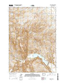
2014 Map of Hope Butte
USGS Topo · Published 2014About this map
Hope Butte and Sugarloaf Butte stand as prominent landmarks in this Malheur County landscape, where water management is the defining feature of the terrain. The presence of the Vale Oregon Main Canal and a series of specialized catchments, including Willow Cr Reservoir 1, Willow Cr Reservoir 2, and the Hope Flat Reservoir, illustrates the critical role of irrigation and livestock watering in this arid region. The drainage network of Bully Cr and Cottonwood Cr is supplemented by numerous natural water sources like Hot Spring, Coyote Spring, and Foster Spring. This 2014 survey documents a modern cattle-ranching and agricultural environment, where the infrastructure of reservoirs and springs supports life between the rocky buttes. The Bully Cr Reservoir dominates the southern portion of the map, serving as a primary focal point for the surrounding watershed and local transport via Reservoir Rd.
Find a feature on this map
33 named features on this map. Tap any name to fly to it.
Don’t see what you’re looking for? This feature index may not catch every label — zoom into the map to look around manually.
Map Details
Editions of this 2014 Hope Butte Map
This is the sole edition of this map. No revisions or reprints were ever made.
Other maps of this area

1906 · Mitchell Butte
USGS Topo · 1:125,000

1950 · Jamieson
USGS Topo · 1:62,500

1955 · Baker
USGS Topo · 1:250,000

1955 · Boise
USGS Topo · 1:250,000

1958 · Boise
USGS Topo · 1:250,000

1959 · Baker
USGS Topo · 1:250,000

1962 · Boise
USGS Topo · 1:250,000

1964 · Brogan
USGS Topo · 1:62,500

1966 · Harper
USGS Topo · 1:62,500
1967 · Vines Hill
USGS Topo · 1:24,000