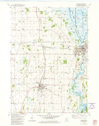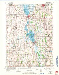
1955 Map of Horicon
USGS Topo · Published 1971About this map
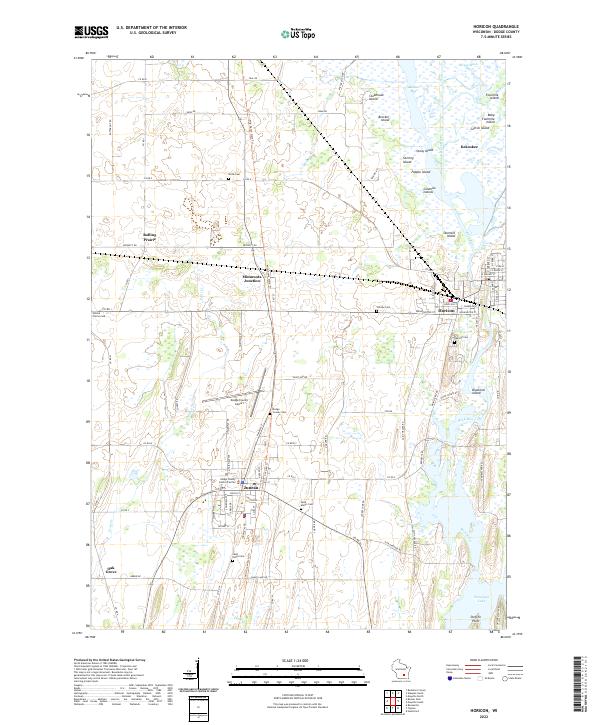
Horicon Marsh Wildlife Area dominates the northern landscape of this Dodge County study, where the Rock River feeds into a vast network of islands such as Fourmile Island and Cotton Island. The mid-1950s environment shows a transition in rural education, with several one-room schoolhouses like American Eagle Sch and Wilson Sch already marked as abandoned, while others like Liberty Bell Sch and Hickory Shade Sch remain active landmarks. The rail infrastructure is particularly dense, with the Chicago and North Western and Chicago Milwaukee St Paul and Pacific railroads intersecting at hubs like Minnesota Junction and Clyman Junction. Further south, the impounded waters of Sinissippi Lake are surrounded by small island clusters and points, including Steffen Point and Kinkel Point, reflecting the region's complex hydrology and long-standing drainage patterns.
Find a feature on this map
99 named features on this map. Tap any name to fly to it.
Don’t see what you’re looking for? This feature index may not catch every label — zoom into the map to look around manually.
Map Details
Editions of this 1955 Horicon Map
This is the sole edition of this map. No revisions or reprints were ever made.
Historical Maps of Mayville Through Time
7 maps found