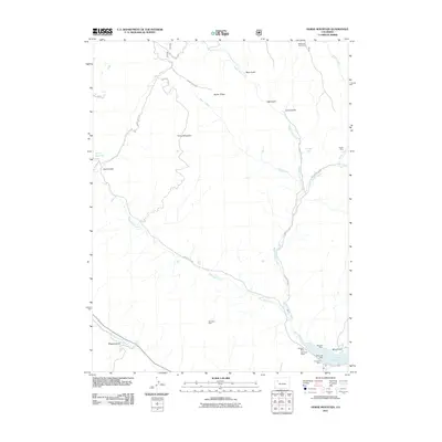
2011 Map of Horse Mountain
USGS Topo · Published 2011About this map
Horse Mountain and the surrounding high country of Garfield County are defined here by a network of drainage gulches and small-scale mining operations. The landscape is carved by the diverging branches of Middle Rifle Creek, West Rifle Creek, and Brush Creek, which dictate the placement of ranching outposts like the Rifle Creek Cow Camp. This era of development shows a clear reliance on water management and resource extraction, anchored in the south by the Rifle Gap Reservoir and the Rifle Gap Dam.
Find a feature on this map
31 named features on this map. Tap any name to fly to it.
Don’t see what you’re looking for? This feature index may not catch every label — zoom into the map to look around manually.
Map Details
Editions of this 2011 Horse Mountain Map
This is the sole edition of this map. No revisions or reprints were ever made.
Other maps of this area

1906 · Grand Hogback
USGS Topo · 1:125,000

1910 · Grand Hogback
USGS Topo · 1:125,000

1952 · Rio Blanco
USGS Topo · 1:24,000

1952 · Anvil Points
USGS Topo · 1:24,000

1952 · Horse Mountain
USGS Topo · 1:24,000

1952 · Rifle
USGS Topo · 1:24,000

1957 · Leadville
USGS Topo · 1:250,000

1959 · Leadville
USGS Topo · 1:250,000

1960 · Leadville
USGS Topo · 1:250,000

1962 · Leadville
USGS Topo · 1:250,000