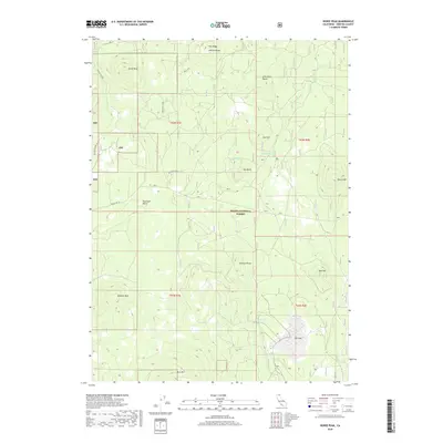
2018 Map of Horse Peak
USGS Topo · Published 2018About this map
Shasta National Forest dominates this landscape in Siskiyou County, where several volcanic-related summits like Horse Peak, Asperin Butte, and Oso Butte rise above the surrounding terrain. The region is marked by its numerous natural springs, including Bear Spring, Deter Spring, and Point Spring, which have historically provided critical water sources in this high-altitude environment. Transport through the forest is facilitated by early-twentieth-century routes such as Stevens Pass Rd and Forest Rte 13, which connect the various ridges and peaks. To the east, Toad Mtn and Harris Mtn stand near Toad Lake and the seasonally dry bed of Dry Lake, illustrating the complex drainage patterns of the southern Cascades. Geologic landmarks like Masonic Rock and Lookout Point further define the high-relief character of the territory during the late twenty-first century.
Find a feature on this map
27 named features on this map. Tap any name to fly to it.
Don’t see what you’re looking for? This feature index may not catch every label — zoom into the map to look around manually.
Map Details
Editions of this 2018 Horse Peak Map
This is the sole edition of this map. No revisions or reprints were ever made.
Other maps of this area

1886 · Modoc Lava Bed
USGS Topo · 1:250,000

1892 · Modoc Lava-Bed
USGS Topo · 1:250,000

1932 · Bartle
USGS Topo · 1:96,000

1939 · Bartle
USGS Topo · 1:125,000

1950 · Bray
USGS Topo · 1:62,500

1952 · Medicine Lake
USGS Topo · 1:62,500

1954 · Alturas
USGS Topo · 1:250,000

1958 · Alturas
USGS Topo · 1:250,000

1961 · Hambone
USGS Topo · 1:62,500

1961 · Bartle
USGS Topo · 1:62,500