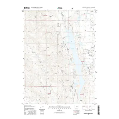
2016 Map of Horsetooth Reservoir
USGS Topo · Published 2016About this map
Horsetooth Reservoir dominates the center of this landscape west of Fort Collins, its jagged shoreline divided into distinct sections like Satanka Cove, Soldier Canyon Cove, and Inlet Bay. To the east, the Pleasant Valley and Lake Canal and Larimer County Canal Number 2 indicate the managed water infrastructure supporting the valley. The map is particularly rich in genealogical markers, documenting several family burial sites and individual markers including the Bardwell Family Cem, the Kinnison Family Cem, and a U S Soldier Grave in Mill Canyon. The western heights rise into the Roosevelt National Forest, where prominent summits like Horsetooth Mtn and Arthurs Rock tower over Well Gulch and Happy Hollow Gulch. The northern edge captures the community of Laporte along the Cache la Poudre River.
Find a feature on this map
151 named features on this map. Tap any name to fly to it.
Don’t see what you’re looking for? This feature index may not catch every label — zoom into the map to look around manually.
Map Details
Editions of this 2016 Horsetooth Reservoir Map
This is the sole edition of this map. No revisions or reprints were ever made.
Other maps of this area

1905 · Mount Olympus
USGS Topo · 1:62,500

1906 · Loveland
USGS Topo · 1:62,500

1906 · Fort Collins
USGS Topo · 1:62,500

1907 · Mount Olympus
USGS Topo · 1:62,500

1907 · Livermore
USGS Topo · 1:125,000

1908 · Loveland
USGS Topo · 1:62,500

1908 · Fort Collins
USGS Topo · 1:62,500

1909 · Livermore
USGS Topo · 1:125,000

1954 · Greeley
USGS Topo · 1:250,000

1957 · Greeley
USGS Topo · 1:250,000