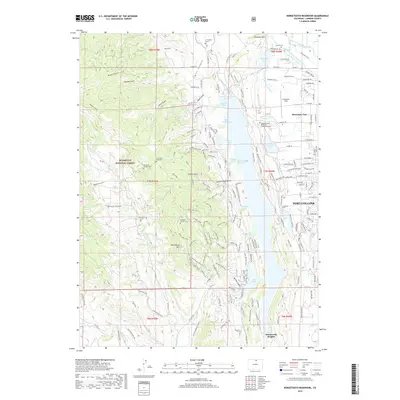
2019 Map of Horsetooth Reservoir
USGS Topo · Published 2019About this map
Fort Collins borders the western edge of the High Plains where the Cache la Poudre River flows near the foothills of the Front Range. This landscape is defined by the massive Horsetooth Reservoir, a centerpiece of local water management with its numerous inlets like Inlet Bay and specialized coves such as Satanka Cove and Soldier Canyon Cove. The terrain rising to the west includes the jagged heights of Horsetooth Mtn and Arthurs Rock, situated within the protected lands of Roosevelt National Forest.
Find a feature on this map
158 named features on this map. Tap any name to fly to it.
Don’t see what you’re looking for? This feature index may not catch every label — zoom into the map to look around manually.
Map Details
Editions of this 2019 Horsetooth Reservoir Map
This is the sole edition of this map. No revisions or reprints were ever made.
Other maps of this area

1905 · Mount Olympus
USGS Topo · 1:62,500

1906 · Loveland
USGS Topo · 1:62,500

1906 · Fort Collins
USGS Topo · 1:62,500

1907 · Mount Olympus
USGS Topo · 1:62,500

1907 · Livermore
USGS Topo · 1:125,000

1908 · Loveland
USGS Topo · 1:62,500

1908 · Fort Collins
USGS Topo · 1:62,500

1909 · Livermore
USGS Topo · 1:125,000

1954 · Greeley
USGS Topo · 1:250,000

1957 · Greeley
USGS Topo · 1:250,000