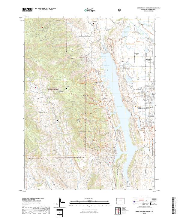
2022 Map of Horsetooth Reservoir
USGS Topo · Published 2022About this map
Horsetooth Reservoir dominates the eastern foothills of the Rockies, creating a complex shoreline of inlets and coves like Satanka Cove and Inlet Bay. The surrounding landscape is a mix of high-altitude forest and critical water infrastructure, where the Charles Hansen Canal and Soldier Canyon Reservoir support the growing western edge of Fort Collins. The western terrain within the Roosevelt National Forest is defined by sharp topographic relief at Arthurs Rock and Horsetooth Mtn. For genealogists and local historians, this survey is exceptionally detailed, noting isolated burial sites such as the U S Soldier Grave and the Patterson Grave, alongside several family cemeteries like the Kinnison Family Cem. The transition from the Cache la Poudre River valley into the rugged gulches reveals how the land is managed for both recreation and municipal utility near the Colorado State University Foothills Campus.
Find a feature on this map
148 named features on this map. Tap any name to fly to it.
Don’t see what you’re looking for? This feature index may not catch every label — zoom into the map to look around manually.
Map Details
Editions of this 2022 Horsetooth Reservoir Map
This is the sole edition of this map. No revisions or reprints were ever made.
Other maps of this area

1905 · Mount Olympus
USGS Topo · 1:62,500

1906 · Loveland
USGS Topo · 1:62,500

1906 · Fort Collins
USGS Topo · 1:62,500

1907 · Mount Olympus
USGS Topo · 1:62,500

1907 · Livermore
USGS Topo · 1:125,000

1908 · Loveland
USGS Topo · 1:62,500

1908 · Fort Collins
USGS Topo · 1:62,500

1909 · Livermore
USGS Topo · 1:125,000

1954 · Greeley
USGS Topo · 1:250,000

1957 · Greeley
USGS Topo · 1:250,000